
WEATHER UPDATE - STRONG WINDS, SEVERE GUSTS, HEAVY RAIN WITH FLOODING TUESDAY AND WEDNESDAY


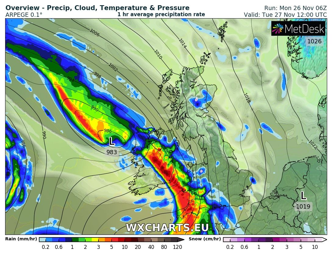
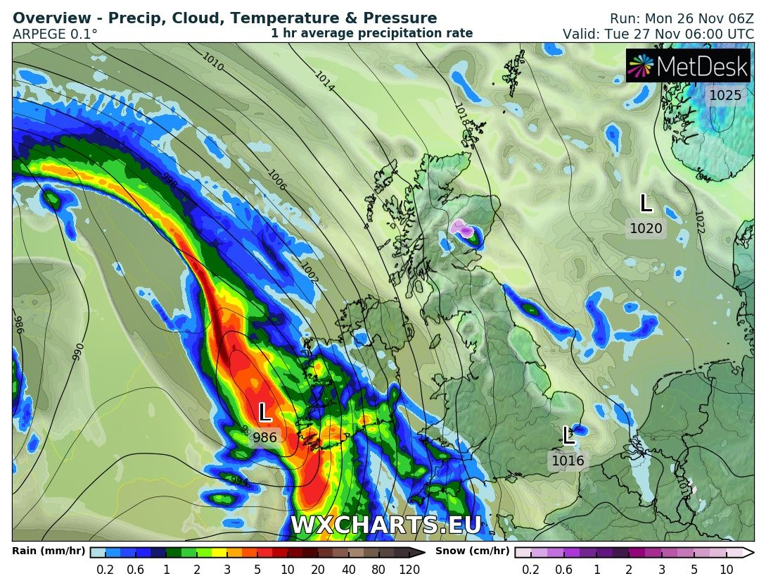
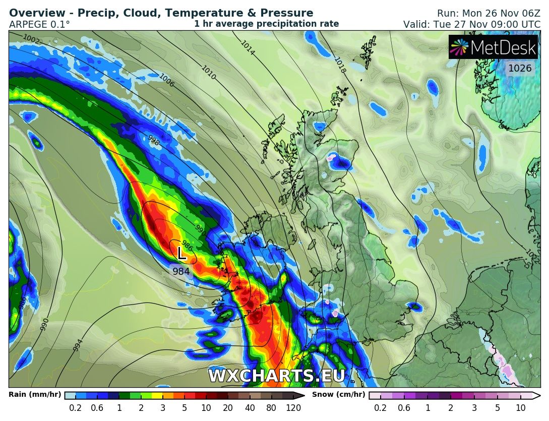
A Spell of wet and windy weather will effect Ireland from Tuesday morning and over the early afternoon with heavy falls of rain for most especially across Western southern and eastern county's. This will be accompanied by a period of strong south easterly winds. Up to 30mm of rain is expected in some lower level areas on Tuesday morning in a short period of time with up to 40mm over higher ground and mountainous areas.
Strong winds will effect coastal county's of Connacht Munster Leinster and west and north Ulster with winds gusting between 90km/hr to 100km/hr.
Continues below


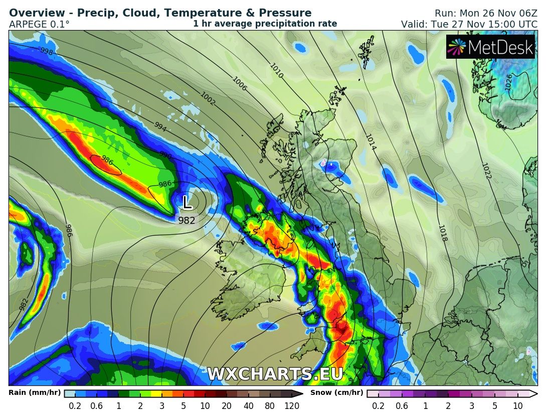
Another spell of wet and windy weather will move into southwestern areas Tuesday night and spread over the county Wednesday morning. Strong winds will also lead to severe and possible damaging gusts along coastal parts of the east, south, west and northern areas with winds gusting up to 125km/hr so a orange weather warning and possible and this storm system has also been named by the Portuguese Met Office as strong Diana
Further weather warnings are likely to be issued on Tuesday for Wednesday with the highest level warning likely to be a Orange Wind warning.
Another spell of heavy rainfall will then effect Ireland on Thursday with the ongoing risk of spot flooding especially over western and northern parts where it will turn persistent.
I will provide further updates over the next 24 hours.
Kenneth from the Donegal Weather Channel

Make sure to give this article a like on Facebook
2019 CALENDAR NOW ON SALE


2019 Calendar now on sale
You can now purchase the Donegal Weather Channel Calendar 2019. You can purchase the Calendar from the online store
All calendars will be posted out in the middle of November with only a limited amount available. Calendars can be purchased anywhere across the world.


The stunning Leitir Mhic An Bhaird (Lettermacaward) Donegal during May 2018

Vivid Rainbow from up on Breezy mountain South Donegal


I was in Albufeira Portugal I was waiting for the full moon to come up and it did not let me down.
The orange and red tints that the Moon sometimes take on rising and setting are caused by the particles in the Earth's atmosphere. When light (or more specifically, packets of light called photons) from an astronomical object passes through the Earth's atmosphere, it scatters off of particles in the latter.

What a unbelievable night and morning out storm chasing, These number of thunderstorms had to be the best in years as most of the lightning was CG bolts. I even manage to captures Two to three CG bolts in one shot.

One of the most beautiful views of Slieve league From sea and got some nice photos.
Photos from this angle I have not seen yet and it was wonderful to finally capture that moment.
Follow Donegal Weather Channel on other social media platforms by clicking the icons below


